
Posting #1: San Francisco (California) to Fallon (Nevada).
With little time to write blog-post's I've decide to post lots of 1-minute videos from along the Lincoln Highway,along with lots of pictures, enjoy!
#1:

Time to start pedalin'!

In San Francisco, over-looking the Pacific coast is the furthest westerly Lincoln Highway marker.


Although using the ferry across the bay from Pier 14 to Vallejo I firstly rode across the
Golden Gate Bridge and back over, for me the official 'start'.
Golden Gate Bridge and back over, for me the official 'start'.

Firstly passing Pier 39.

Full-throttle, hasta la vista San Fran!

Alcatraz, with the Golden Gate bridge behind.

So many rules, regulations and law signs in the U.S.

The Lincoln's highway's department road number.

The old bridge across the river into down town Sacramento.

Some of Sacramento's old-town buildings.


An old truss bridge on part of the 22 mile Sacramento to Folsom route.


This was an excellent bike route!


No uncertainty on which way here....

See the 'driver'?

A Road-side art Pacman

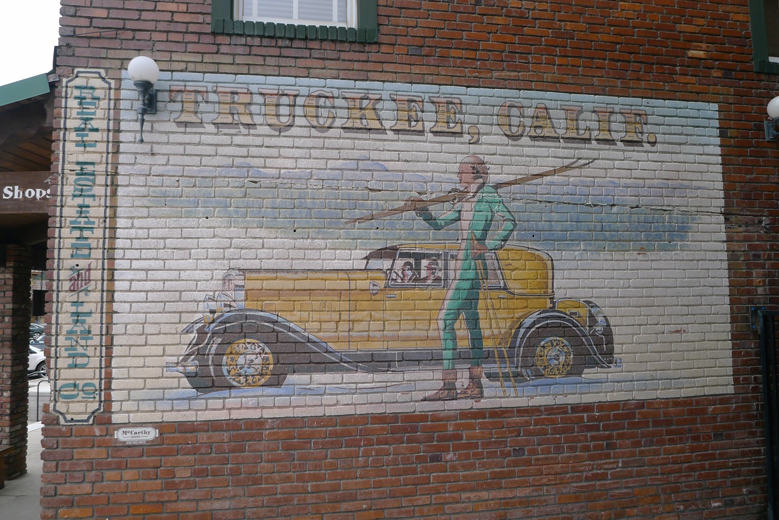
In the town of Truckee.


Posting #2: 28th April 2018, Reno (Nevada) to Delta (Utah)
Yep, that's right folks, a drive-thru wedding, then maybe keeping it themed the same it's to the restaurant.....McD drive-thru.


See the fella climbing?

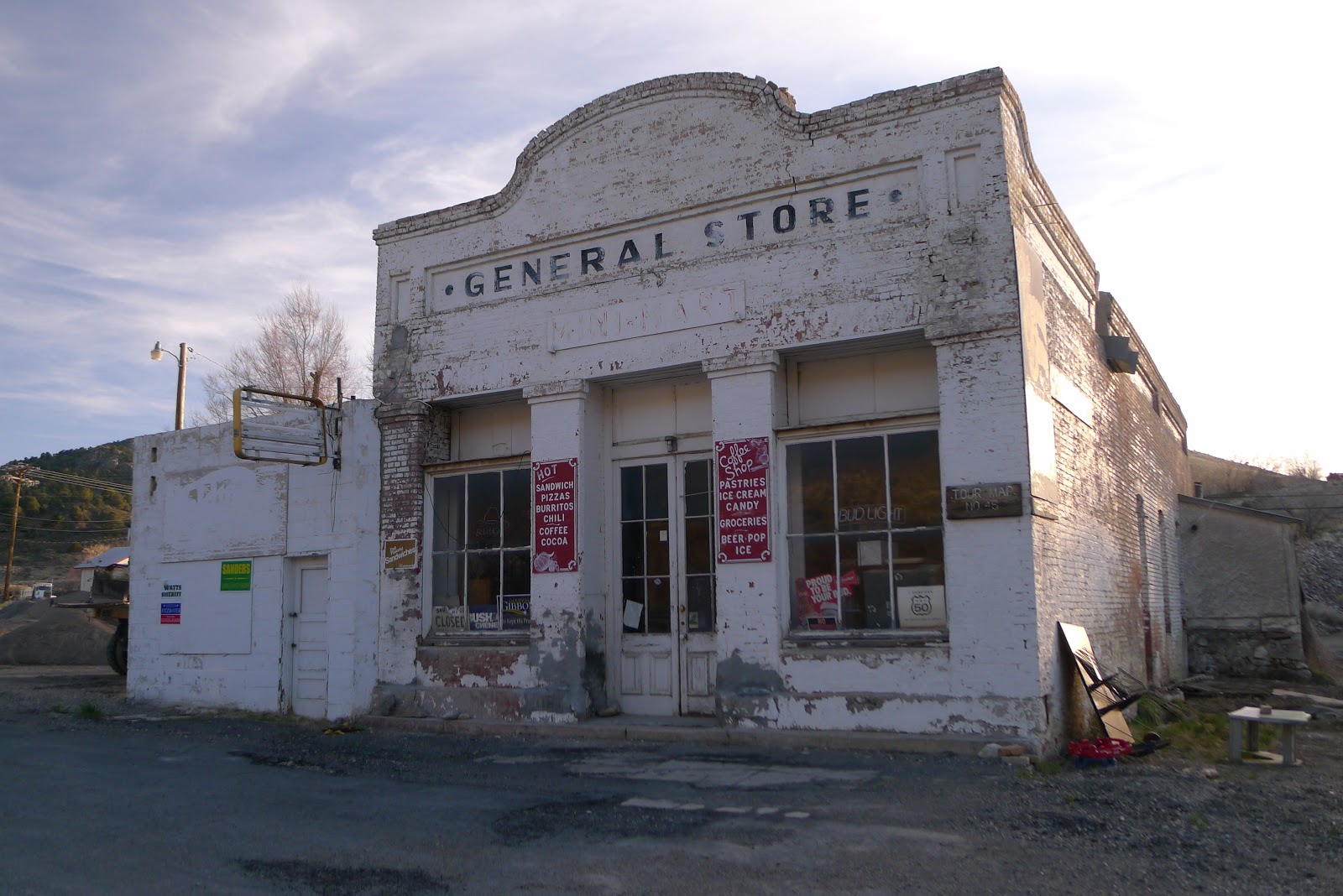
Typically what one would expect from Nevada, casino's....but believe me there's more to it!

Now with just a ride of 27 miles I reach Fallon whereby I'd also pre-arranged host's to stay with and slept in this cool littl' camper-van! A good night was had with (as on all other nights) great food and conversation.


A mile or so along I reach the Shoe-tree (listed on my 'things to see' sheet), U.S. Route 66 also has similar although it fell down several years ago due to the excessive weight of all the shoes hanging from it!


That's all for now cow-boy!

 Arriving at the day's destination town of Elberta I was thinking about camping at the church's neighboring park when an older couple asked if I was okay, explaining myself they said the park was owned by the church - from a service they had just been to - gladly making a call to someone they confirmed I could camp there without a problem. After filling my water bottles at their house they actually invited me to breakfast the following morning! Only last year Jim + Karen had visited England to visit relations so were only too glad to help an Englishman.
 Informing me night-time rain would pass they suggested I make-camp under the pavilion, my tent's just visible at the back corner.
 Loaded up on a home-made waffles and syrup breakfast (no coffee or tea as Mormons do not drink it) I made my way along another quiet road, the sky darkened 360 degrees by grey rain clouds. Thirty miles later I arrive cold and damp at Saratoga and make use of 'Wendy's' national fast-food outlet for a large coffee and chips....or rather 'fries' as one has to ask here for.... when in Rome!


 As seen, a somewhat more appealing than endless grid-road intersections! After a few hours I arrive at my pre-arranged warmshowers.org hosts house and am gladly welcomed in (see my blog's 'hosts' page)
The next morning I head toward the Wasatch Mountains, again taking a more scenic route as opposed to the (latter) Lincoln Highway's interstate I80 I weave over the mountains on a quieter twistly windy road, a few road-cyclists passing and even some people on downhill roller-skis!
The Little Mountain Summit is on the Pioneer Trail route that dates back to the late 1800's from crossings made by the Donner party, Mormons, Pony Express (US mail), California trail and others in search of a better life in the west.


 Eventually at around 7400 feet I reach the main summit, with an extra layer added I zip down a few miles, the easterly side initially appearing to be covered in more fir trees, I expect due to receiving more sunlight.
Reaching the town of Henefer I decide to stop there, the planned town of Evanston was 40 miles away, not too far on the flat but back into the mountains I decided that would wait. The park I rode past even had a (working) tap so made a perfect stop after grabbing a couple of Coffee's from 'Grumps' gas station / grocery store.
 The next day clouds still dressed the sky. My first section was 16 miles of old road before it tapered out, depositing me on the I80 next to the roaring trucks. As seen on ol' 66 many of the old towns had died a death in the hands of 'interstate' progress.


 The inception of the Lincoln Highway caused neighboring towns to fall out in a bid to attain it's 'rightful passage'..passing traffic meant passing business!!


 Also as on 66', the U.S. rail-roads service through here was key, every day I'd here a train rumbling by, some of them with 80 - 100 freight wagons, pulled by 3 - 5 huge locomotives! These stationary wagons were on a siding, can ya make-out what they're carrying?...answers on a postcard..

 The following day with a low mileage of just 44 I reach Evanston. Even here in this 'active' town many of the small business were closed with shop-fronts boarded up, at times it really felt like the U.S. economy was struggling to hang on! With another warmshowers host arranged in town I spend a while checking my onward route, preferring to stay off the interstate where possible I see some more old twisty roads. A man I met in a cafe there said there were three successive climbs know as 'The Three Sisters'. The following morning I ride just 6 miles on the interstate before departing for the old road, soon it peters out with 'pavement ends in 1/4 mile' (pavement in the U.S. means sealed road ~ tarmac). See the 'L' sign?
 It appears the Interstate signs are good for target practice!
 Here in the Wyoming 'badlands'
 An old listed building near Fort Bridger on the old alignment.

 'Little America' proved to be nowt more than a service station with a hotel, more like a posh truck-stop. Luckily for me the westerly winds I'd hoped for had started to blow so I ride on, Green River was the next town along at 20 miles away and was soon reached in just over an hour!! Deciding to take my first room of the trip I settle in to a Western Inn room for $60.
The next day I do my best to follow the old route but it proved too steep and loose rock for sane progress so lift my bike n bags over the barbed fence onto the Interstate. 18 miles later I pull off into Rock Springs. With a couple of points-of-interest on my list to see I conveniently stumble across one of them; 'Grubs' cafe! Having been in business for 70 years I inform the proprietors I'm following the Lincoln Highway and read about their business in the book The Lincoln Highway: Coast to Coast from Times Square to the Golden Gate. Michael Wallis / Michael S. Williamson. Only too glad to help my breakfast was kindly given to me for free! Thanks Grub's!

 How many rims can you count?...answers on a postcard..

 Another derelict gas station aside the I80.

 Yeeehooo!!! Now on the eastern side of the Continental divide...rain on this side flows to the Atlantic ocean, on the western side into the Pacific. Here I'd been gingerly pedaling along at an awesome 23 mph!!! 23!!...thanks tail-wind!!
 No towing needed with this wind!
 Wamsutter was a strange place. Once a main stop for the steam locomotives. A thriving town developed to support it's needs but is hay-day is well over. For a moment my excitement peaked when I saw a relatively new supermarket shop but thought it strange the car park was empty...as was the building itself!! So for now the only 'groceries'' available were from either the Conoco or Loves gas stations! I camped that night next to the town's church..quiet..no, as it was slap-bang next to the interstate!

 I just love the flames!!
 Fireworks seemed big business in Wyoming...although strangely always out-of-town
 In Rawlins I saw this cool 'biderectional' car.


 Twenty miles out from Rawlins I depart the Interstate for an excellent section of the old route, bobbing up and down through gentle climbs distancing myself from the trucks I first reach Hanna, parlty tempted to camp there I decide to dig a bit deeper and reach Medecine Bow 20 miles further, that would be my first 100 miler since Route 66...ten years ago! With the wind still on my back and white clouds I'd have been silly not to carry on! On arriving at Medecine Bow I ask two men if there was anywhere to camp, the older guy says (in a broad American accent), "Ya know it's e-legal to ryde wona those in Wyoming?...most cow-boys 'ould knock ya off the road!" We all laughed and soon I'm directed over to where one of the men 'Dusty' has a campervan trailer that I can pitch next to...later he even lets me use his shower!!

 Good to see another marker!
 The town quaint, even with wild deer ambling around the place eating uncut grass & whatever they like, with their ears on 'look-out' they seemed care-free. A shame the passing trains broke the silence with their blaring horns, else a good night's sleep.
 Another cool 50's pick-up!
 Onward the next day 15 miles from Medicine Bow I reach another of my list's 'things-to-see, Fossil Cabin. A ranch made from not bricks or stones but......dinosaur bones!! In the 1870/80's paleontologists had unearthed a vast discovery of pre-historic bones making Como Bluff one of the most important Jurassic fossils areas in the world.
 A few miles past here my Medicine Bow buddy Dusty drives by, pulling over he ask's if I'd like a lift. With a long day still ahead and the bleak scenery I gladly accept his offer! He was driving the 46 miles to Laramie to wash clothes at a launderette and also meet his friend over breakfast. His crazy dog 'Cooper' was in his pick-up jumping around the cabin as the mad-as-ever dog he was! Here's Dusty (left) and his mate outside the restaurant.

Considering I was almost past the Rockies it was saving the best for last, my highest mountain pass climb, maxing at at 8640 feet I had about 2000 feet (600 metres) to climb, nothing too much and the interstate road slowly climbed up over ten miles. Slowly but surely I reached the summit to where a huge monument-statue of President Lincoln over-looked the road.
 A local visitor at the visitors center informed me about taking the 'Happy Jack Road' down to Cheyenne where I'd stay that night with pre-arranged hosts. 37 truck-free / minimal traffic miles later I'm rolling into town and at the door of my welcoming hosts Jolene + Ted..and Aspen, their collie sheep-dog.
Next up I cross into Nebraska, where the road descends and becomes long and straight through the endless prairie fields.
Posting #3: 7th May 2018, Delta (Utah) to Cheyenne (Wyoming)
Although my chosen route to Salt lake City (SLC) was not part of the Lincoln Highway it proved to be the expected traffic-free route, passing occasional farms and small villages, with a reminder of the industry.

A rather cool old car rusting away in the 2nd same-name town of Eureka (Utah).


Snow-caped mountain peaks surrounded me as I made my way closer to SLC.

Before departing, researching my route back home I'd found a 16 mile river trail in the south - north direction I'd be on, that mean no intersection traffic lights and great scenery, it proved to be a delight!!
Making my way to the river trail's start.


The next morning I head toward the Wasatch Mountains, again taking a more scenic route as opposed to the (latter) Lincoln Highway's interstate I80 I weave over the mountains on a quieter twistly windy road, a few road-cyclists passing and even some people on downhill roller-skis!
The Little Mountain Summit is on the Pioneer Trail route that dates back to the late 1800's from crossings made by the Donner party, Mormons, Pony Express (US mail), California trail and others in search of a better life in the west.


Reaching the town of Henefer I decide to stop there, the planned town of Evanston was 40 miles away, not too far on the flat but back into the mountains I decided that would wait. The park I rode past even had a (working) tap so made a perfect stop after grabbing a couple of Coffee's from 'Grumps' gas station / grocery store.


Either way, so long as I'd occasionally see the red, white and blue sign I'd be happy.


One of the mile-long trains chuggs past as I approach Little America.

The next day I do my best to follow the old route but it proved too steep and loose rock for sane progress so lift my bike n bags over the barbed fence onto the Interstate. 18 miles later I pull off into Rock Springs. With a couple of points-of-interest on my list to see I conveniently stumble across one of them; 'Grubs' cafe! Having been in business for 70 years I inform the proprietors I'm following the Lincoln Highway and read about their business in the book The Lincoln Highway: Coast to Coast from Times Square to the Golden Gate. Michael Wallis / Michael S. Williamson. Only too glad to help my breakfast was kindly given to me for free! Thanks Grub's!


Considering I was almost past the Rockies it was saving the best for last, my highest mountain pass climb, maxing at at 8640 feet I had about 2000 feet (600 metres) to climb, nothing too much and the interstate road slowly climbed up over ten miles. Slowly but surely I reached the summit to where a huge monument-statue of President Lincoln over-looked the road.

Next up I cross into Nebraska, where the road descends and becomes long and straight through the endless prairie fields.
- - - - - - - - - - - - - - - - - - - -